AccuWeather Global Weather Center – AccuWeather meteorologists are closely monitoring a storm that has the potential to bring a stripe of accumulating snow from parts of the Midwest to the Northeast early next week.
Warmth before the storm
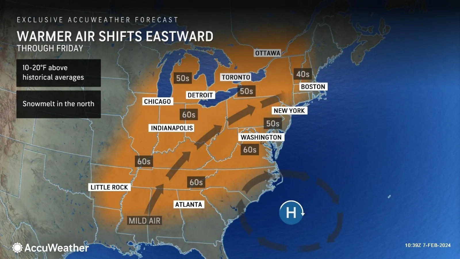
In the short term, temperatures will be on the upswing in the wake of an Atlantic storm that buried Nova Scotia under feet of snow earlier this week. A flow of dry air has already delivered days of bright sunshine and cold nights to much of the central and eastern United States.
As that Atlantic storm moves away, a southwesterly flow of air will expand from the Central states to the East into Friday.
At their peak Thursday and Friday, highs will range from the 40s F over the northern tier of New England to widespread 50s around the Great Lakes, central Appalachians and upper mid-Atlantic to the 60s over much of the Ohio Valley and Southern states.
However, the clock will be ticking on the warmer weather pattern as soon as it begins.
Chance of snow increases as warm weather fades away
“While the January thaw and break from the stormy pattern extended into early February, there is going to be a change in the pattern with a potentially impactful storm coming swinging across the Midwest and Northeastern states from Monday to Tuesday,” AccuWeather Meteorologist Dean DeVore said.
The storm potential DeVore alluded to includes a broadening stripe of accumulating snow that may first appear over parts of the southern High Plains on Sunday and extend across portions of the lower Mississippi Valley to the Ohio Valley from Sunday night to Monday. However, the amount of snow that falls in this area could be limited as the air may not be quite cold enough, resulting in more raindrops than snowflakes.
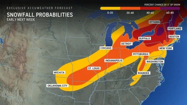
“Colder air will gradually be drawn into this storm as it moves from the Central states to the Eastern Seaboard,” AccuWeather Chief On-Air Meteorologist Bernie Rayno said. “How quickly that occurs will depend on how fast the storm strengthens.”
If the storm remains weak, it will likely race northeastward with only small snow accumulations from the Ohio Valley to the central and southern Appalachians and perhaps a wintry mix at worst in the mid-Atlantic late Monday into Tuesday.
Should the storm organize and strengthen, it would track farther north to produce a broadening swath of accumulating snow, some of which can be heavy, from the central Appalachians to New England, with drenching rain and thunderstorms to the south.
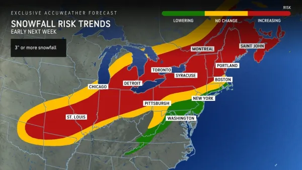
Both scenarios and others that include a major nor’easter and only spotty precipitation are still in play. Most of these would still allow some snow to fall from the Ohio Valley to parts of the Appalachians.
AccuWeather Chief Meteorologist Jonathon Porter shared “AccuWeather long-range forecasts have been calling to a change to colder, stormier weather for the second half of February in the East. This pattern change is in line with that accurate forecast, ushering in colder weather and also snow risks from time to time”
“One thing is for sure, this storm will start a pattern that brings colder, more active weather from the Midwest to the Northeast with reinforcing shots of seasonably cold air masses with the potential for some clipper systems to bring snow events,” DeVore said.